Palccoyo
Palccoyo
Palccoyo, a collection of colorful mountains south of Cusco, offers short hiking at 4,900 m altitude, a quieter alternative to Vinicunca.
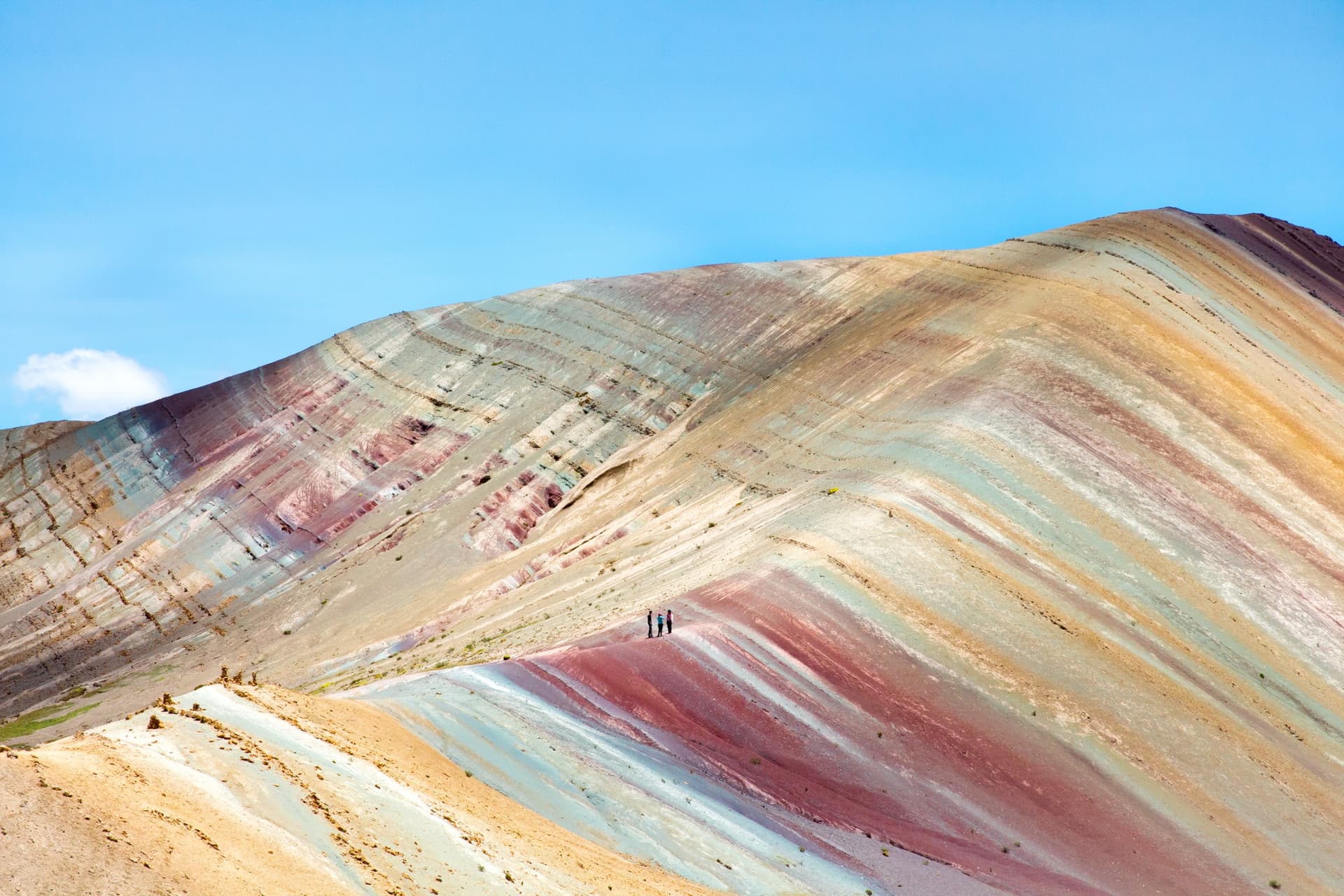
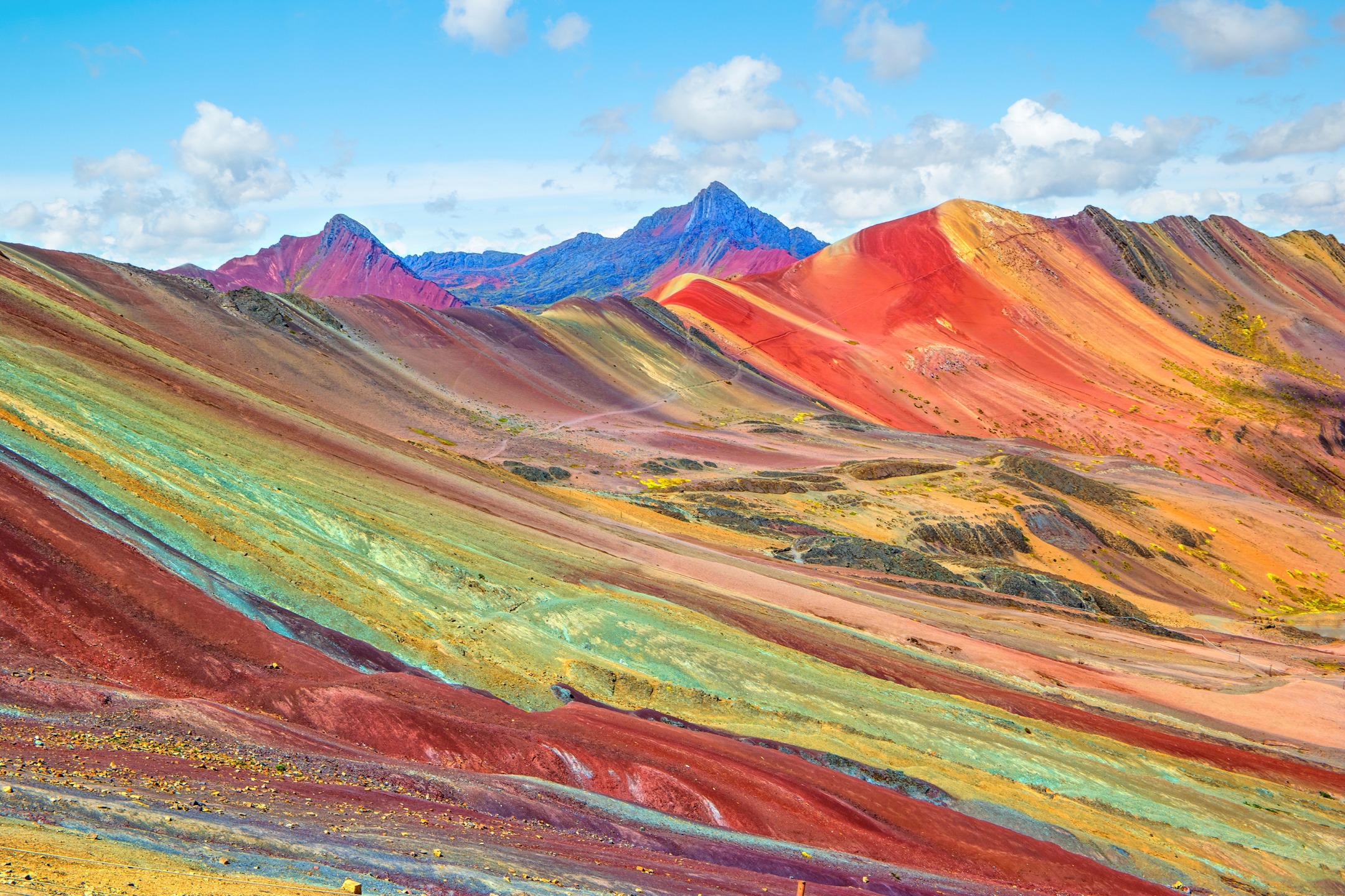
Palccoyo is a collection of colorful mountains located in the Cusco region, south of Pérou. Approximately 100 km southeast of Cusco city, this Andean site offers a quieter and more accessible alternative to its neighbor Vinicunca, the famous Rainbow Mountain. The trail is short, the slope moderate, and the panorama features three ridges striped with red, pink, green, blue, white, turquoise, purple, yellow, and ochre.
Why visit Palccoyo
Palccoyo stands out from Vinicunca in three concrete ways. First, the crowds: the site receives significantly fewer visitors, which transforms the experience on the ground. Second, the difficulty: the access trail is short, over gently sloping terrain, making it accessible to less experienced hikers or families accustomed to altitude. Finally, the landscape: three colorful ridges are visible instead of one, accompanied by a forest of eroded stone formations and a red valley nearby.
The site remains at high Andean altitude, with a summit around 4,900 meters. Prior acclimatization in Cusco is essential.
What to see on site
The three colorful ridges
The main observation platform is about 100 meters from the parking area. From there, the eye sweeps across three lines of striped ridges. The colors come from deposits of copper oxide, iron oxide, sandstone, and red clay, accumulated beneath a shallow sea millions of years ago, then uplifted by the tectonic movements that formed the Andes. Erosion by wind and water subsequently exposed the mineral layers, creating the current palette: red, pink, green, blue, white, turquoise, purple, yellow, ochre.
The forest of giant stones
On the path between the parking area and the ridges, rocky monoliths carved by erosion form an ensemble locally called the "stone forest." The upright blocks contrast with the colored bands in the background.
The red valley
In the immediate vicinity, a valley with intense red hues extends over several hundred meters. The dominant color comes from clay rich in iron oxide.
Llamas and alpacas
The site is used as a grazing area by local communities. Herds of llamas and alpacas roam freely along the trail.
How to get there from Cusco
By private or rental vehicle
Plan for approximately 3 hours of driving from Cusco. The route follows the main road heading south, then turns left just before Combapata toward the Puente de Checacupe. The final section is on a dirt track for about 1 hour of driving, ending at the site's parking area. From parking, a stone path reaches the observation platform 100 meters away.
By bus then collective taxi
A bus connects Cusco to Combapata in 2.5 to 3 hours. From there, a collective taxi serves the Palccoyo community for approximately 1 hour. The starting point for the hike is at the place called Huallara, accessible by the final dirt track.
By organized tour
Many agencies in Cusco offer day trips with round-trip transportation, breakfast, and lunch included. This is the simplest option for travelers without a vehicle, and the most practical given the road elevation and altitude.
When to visit Palccoyo
The dry season, from May to September, offers the best conditions: sunny days, clear skies, vivid colors, and passable trails. It is also the high tourist season, but visitor numbers remain incomparable to those at Vinicunca.
The rainy season, from November to March, makes the access track difficult and trails muddy. The landscapes are greener and visitor numbers lower, but the risks of landslides and reduced visibility are real.
Practical advice
- Acclimatization: spend at least two to three days in Cusco or the Sacred Valley before your visit. The highest point exceeds 4,800 meters.
- Clothing: layered system, windproof and waterproof jacket, hat, gloves, sunglasses. Weather changes quickly at altitude.
- Sun protection: high UV index, sunscreen and hat essential, even in overcast conditions.
- Water and food: bring water and snacks. No shops on the trail.
- Cash: an entrance fee is collected by the local community, payable in soles.
- Early departure: morning light brings out the colors better and limits exposure to afternoon storms.
What to see nearby
The village of Checacupe, located on the route, preserves three adjacent bridges: an Inca bridge made of woven fibers, a colonial stone bridge, and a republican bridge. A stop of about thirty minutes is enough to see them.
More broadly, the Cusco region includes several sites accessible within the same week. The chapel of Andahuaylillas, sometimes called the "Sistine Chapel of the Andes,
Interested in this visit?
We can include it in your personalised itinerary.