Canyon de Los Perdidos
Canyon de Los Perdidos
South of Ica, Canyon de Los Perdidos spans 5 km of gorges and 600 m of depth over an ancient seabed rich in fossils, reached after 4 hours across desert trails.
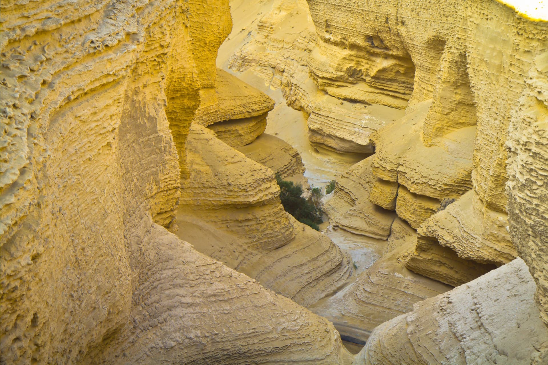
Canyon de Los Perdidos stretches approximately 5 kilometers in length and reaches nearly 600 meters in depth, in the heart of the Ocucaje desert, in the Ica region, southern Pérou. Its erosion-carved walls reveal an ancient seabed dating back 20 to 30 million years, where fossils of whales, sharks, penguins and shells tell an improbable oceanic past amid the sand.
Why visit Canyon de Los Perdidos
This site remains off the beaten path of classical Pérou tourism. Three elements set it apart:
- Unique geology: the sedimentary layers exposed by erosion date back 20 to 30 million years and bear witness to the ancient presence of the ocean in what is now an arid zone.
- Visible marine fossils: the Ocucaje region is known among paleontologists for its remains of prehistoric whales and penguins. On-site, shell fragments and bone remnants still emerge from the rock.
- Low visitor numbers: rediscovered about fifteen years ago, the canyon attracts mostly visitors willing to venture from Ica, which preserves a peaceful atmosphere.
History and rediscovery
The canyon formed over an ancient seabed gradually uplifted then sculpted by water and wind. The rock formations that compose its walls date back approximately 20 to 30 million years. The Ocucaje region is one of Pérou's most thoroughly documented marine fossil deposits.
The site itself was only identified as a tourist attraction in the early 2010s. In 2011, an expedition organized by the Ocucaje Association for Tourism and Cultural Promotion (APTYCO) ventures into this portion of the desert. Part of the group becomes lost along the way, an episode that inspired journalist Maycol Herrera Benavides to name it the "Canyon of the Lost." The name quickly took hold.
The expedition was unaware at the time that the canyon falls administratively within the Santiago district, which necessitated steps to clarify site management.
What to see on site
The route comprises several distinct sections, typically linked during a single visit:
- The mouth of the Ica River: verdant area at the desert's edge, where migratory herons can be observed.
- The gorge: the canyon's widest and deepest section, whose steep walls form the heart of the visit.
- Plaza Caracol: spiral formation resembling a shell, partially covered by a natural rock roof.
- The Puma's Face: rocky relief where erosion has revealed a silhouette evoking a feline's head.
- Ojo de Pez: stagnant water well located beneath the Puma's Face, fed by rain and underground seepage.
When to go
The dry season, from May to September, remains the most favorable period. Dirt roads are passable, temperatures remain manageable and lighting accentuates the contrast of the walls. During the rainy season, October to April, trails can become difficult or impassable and midday heat complicates hiking.
How to get there
Access is from Ica, which serves as a logistical base. Allow approximately 4 hours of travel to reach the canyon from the city (depending on sources and trail conditions, some more direct routes take less time).
- By personal vehicle: from Ica, take the Panamericana Sur to Ocucaje (about 30 minutes), then take the dirt trails that penetrate the desert. A 4x4 is necessary for the final portion.
- With a local agency: operators based in Ica organize day excursions including transport, guide and water. This is the simplest option for a first trip to the area.
Practical information
- Visit duration: plan a full day from Ica, including transport.
- Difficulty level: moderate walking on uneven terrain; sturdy closed-toe shoes essential.
- Water and food: no facilities on-site. Bring several liters of water per person and provisions.
- Protection: hat, sunglasses, sunscreen and windbreaker. Temperature swings between shade and direct sun are significant.
- Local guide: recommended. The canyon is not marked and navigating the desert requires experience.
Nearby attractions
The Ica region concentrates several complementary sites accessible during the same trip. The Huacachina oasis, the Nazca Lines and the Paracas reserve can all be visited from the same base. To extend the route toward the southern Andes, you can reach archaeological sites such as the Ollantaytambo ruins, the Q'enko sanctuary or the Andahuaylillas chapel. Further north of Lima, the Caral citadel completes the panorama of the country's major historical sites.
Frequently asked questions
Frequently asked questions
Preparing your trip
Canyon de Los Perdidos naturally integrates into an itinerary combining desert, archaeology and Andean altitude. To build a custom journey including this site and other stages along the southern coast, consult our Pérou travels.
Interested in this visit?
We can include it in your personalised itinerary.