Torotoro
Torotoro
An Andean village perched 140 km from Cochabamba, Torotoro is home to an exceptional national park: dinosaur footprints, vertiginous canyons, and a labyrinthine cave.
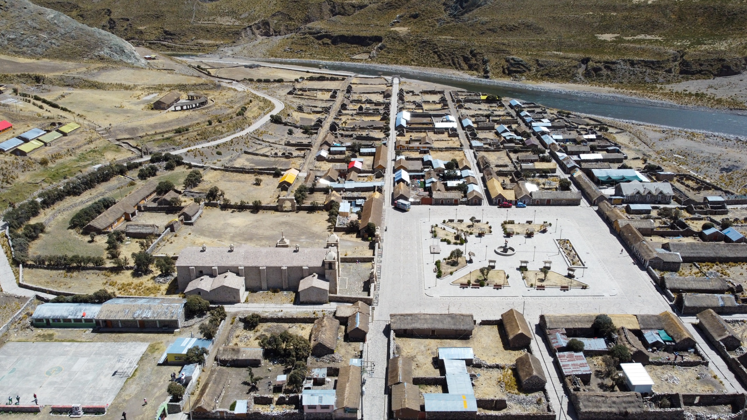
Torotoro is a small village nestled in the Bolivian Andes mountains and a true gem still unknown to the general public. Located north of the Potosí department, in Charcas province, it sits at an altitude between 1,900 and 4,000 meters, about 140 km from Cochabamba. Torotoro is a paradise for nature lovers, geology enthusiasts, and those fascinated by prehistoric history. With its spectacular landscapes, vertiginous canyons, and mysterious caves, its national park is one of the most fascinating and unique places in Bolivia. If you're a traveler seeking adventure off the beaten path, Torotoro is a destination that will surely leave you in awe.
Climate
Torotoro has a temperate to cold climate in winter. Temperatures vary according to altitude but are generally stable. When summer arrives, temperatures reach around 30°C, and during winter, they drop to about 10°C. It's also worth noting that accessing the village during the rainy season is challenging. The best time to visit Torotoro is during the dry season, from May to October. The weather is more favorable for trekking and outdoor exploration.
A National Park of Exceptional Richness
Torotoro National Park was created in 1989 to protect the Paraba Frente, a rare macaw. This is a species of parrot endemic to the region, characterized by its red front. The park covers an area of approximately 165 km².
This territory is an open-air geological museum. It is also a refuge for 49 animal species, including the red macaw, the titi (Andean cat), the taruka (Andean deer), the puma, and more. It also harbors approximately 600 plant species, including 329 varieties of flowers.
Dinosaur Footprints
One of the most fascinating aspects of Torotoro is undoubtedly its perfectly preserved dinosaur tracks on the clay plains of Carreras Pampa. Visitors can observe hundreds of footprints, some measuring more than 80 cm in diameter. These traces offer insight into the movements and migrations of dinosaurs that inhabited the region during the Late Cretaceous period, between 137 and 65 million years ago.
According to certain studies, Torotoro was a coastal zone where different species of dinosaurs thrived. It was, in a sense, a beach resort for prehistoric animals. Since the ground was muddy and soft beneath the feet of these massive creatures, it allowed the dinosaur footprints to be preserved, aided by marine sediments.
In fact, the name Torotoro comes from the Quechua "thuru thuru," which means mud, alluding to the damp earth in which these prehistoric animals left their traces. Paleontological research has identified the dinosaurs, notably predators (T-Rex, Giganotosaurus, Velociraptor, etc.) and herbivores (Diplodocus, Brachiosaurus, etc.).
Torotoro Canyon
With a depth of more than 250 meters, Torotoro Canyon is a must-see in the park. It is accessible after a trek that leads to breathtaking viewpoints and allows visitors to discover bird species such as condors and eagles, or even parrots.
To access the canyon floor, you must descend approximately 700 steps. At the bottom, the El Vergel river forms natural pools where visitors can swim in crystalline water, surrounded by imposing rock walls.
Umajalanta Cave
Located about thirty minutes' walk west of Torotoro village, Umajalanta Cave is one of the longest and deepest in the country. This cavern, more than 4.6 km long, can be explored in less than 2.5 hours. It's a true underground labyrinth with 5 km of galleries. Visitors explore only 1.5 km, where they can admire:
- Impressive limestone formations
- An underground river
- Bats
Exploring this cave requires a headlamp and a good dose of courage. Narrow passages, rappelling descents, and immense chambers make the experience worthwhile.
Ciudad de Itas
Located about 21 km from Torotoro village, at 4,000 m altitude, Ciudad de Itas is another fascinating curiosity in the park. It is a series of rock formations eroded by wind and rain. The erosion has created a strange and surreal landscape resembling a stone city. Forming an authentic labyrinth, the 20-meter-high rocks are adorned with cave paintings, probably drawn by pre-Columbian populations. You can see representations of animals, humans, and geometric patterns made with red paint.
To reach Ciudad de Itas, you must be in good physical condition and undertake a trek lasting 2 to 3 hours. Hikers can explore these formations while wandering through this almost lunar landscape.
Rock Waves
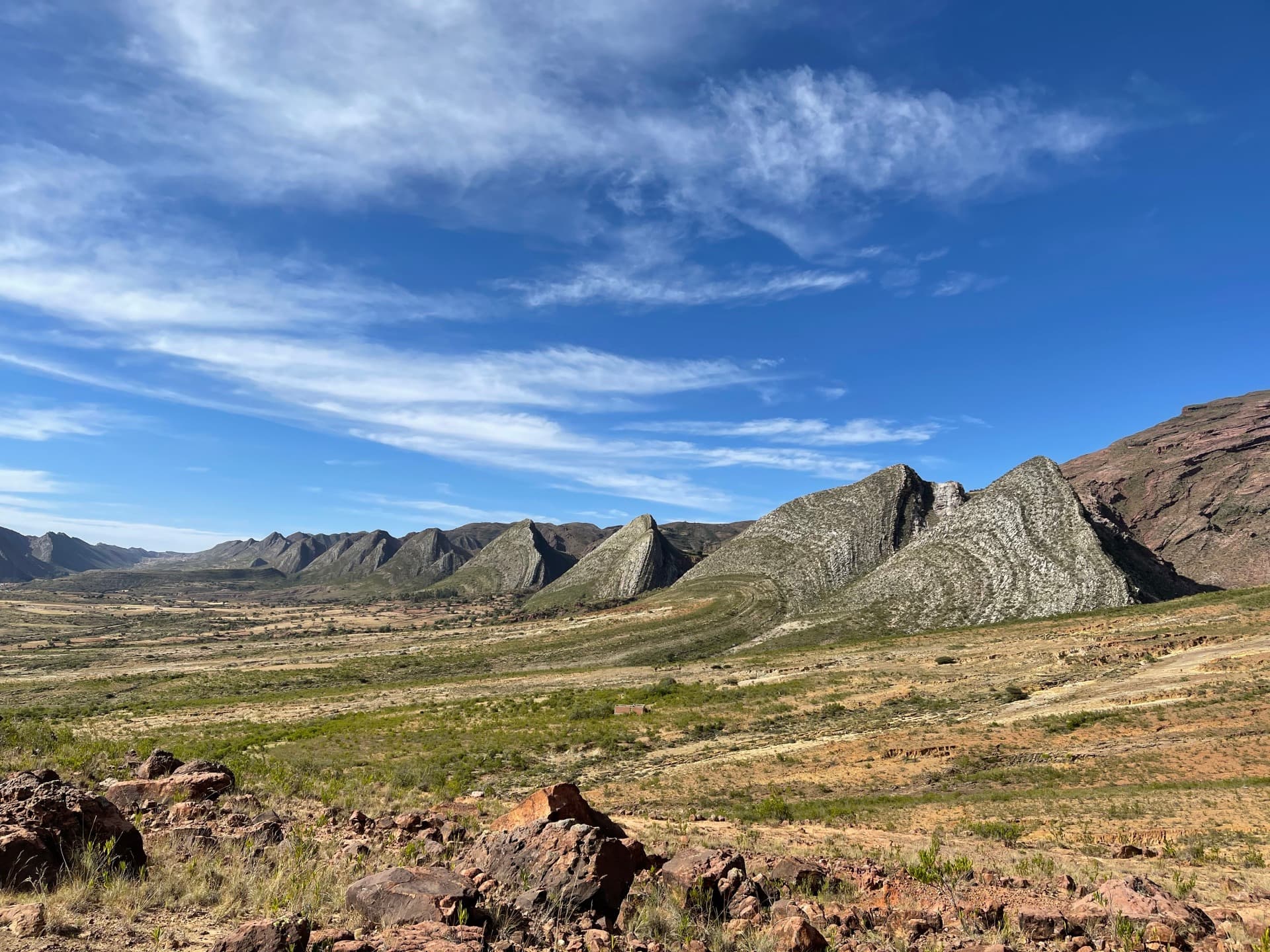
Rock waves are large undulations of rock formations that resemble waves frozen in time. These structures formed over millions of years due to complex geological processes, including tectonic movements, climate conditions, and erosion. Sedimentary rock layers have been folded and sculpted by natural forces, creating undulating patterns.
Torotoro's rock waves are particularly remarkable for their size and regularity, offering visitors a striking natural spectacle. They attract geologists, tourists, and photography enthusiasts who come to explore this area and admire the beauty and uniqueness of these formations.
Cementerio de Tortugas
Located 3.5 km from Torotoro village, the Turtle Cemetery harbors several fossils of turtle shells, fish, and crocodiles dating from the Late Cretaceous. Once, this area was a vast muddy marine swamp where many herbivorous and carnivorous animals lived.
Torotoro is accessible from Cochabamba, with a bus or private vehicle journey lasting approximately 4 to 5 hours. The roads, though winding and unpaved, offer breathtaking panoramas. It's worth noting that buses depart daily. They wait until full and leave from 6 a.m. onward.
Torotoro Today
Torotoro is not only a place of natural wonders; it's also a village situated on a small plain at 2,700 m altitude, overlooking the Rio Caine valley. Quechua culture is very much present there. The inhabitants, often dressed in traditional attire, are warm and welcoming. Life in Torotoro is simple, rhythmed by agricultural seasons and local festivals, such as the San José festival, the village's patron saint celebration, held each March.
Moreover, Torotoro has several hotels and guesthouses offering simple but comfortable accommodation. There is also a park guides office. Additionally, the Pachamama Wasi museum, or House of Mother Earth, displays an important collection of stones and fossils. These were gathered in the park by a Torotoro resident over 22 years of exploration. This elderly gentleman warmly welcomes visitors and shares his knowledge about the region's history.
Activities
Torotoro is the ideal destination for hikers and adventurers. The park offers several trails, ranging from easy walks to more demanding treks. Local guides are mandatory and provide invaluable assistance in discovering the most interesting sites while learning about natural history and local culture.
Trek to Torotoro Canyon
A popular trek is the one leading to the edge of Torotoro Canyon. This trail offers spectacular views and the opportunity to descend to the bottom to swim in natural pools.
Expedition to Umajalanta Cave
For the adventurous, exploring Umajalanta Cave is a unique experience. Visitors must squeeze through narrow passages, climb rocks, and cross underground rivers to discover the hidden beauties of the cavern.
Practical Tips
It's important to note that regardless of the number of visitors, the rate for a local guide is fixed. It is recommended to form groups of no more than 6 people to share the guide's cost. It's possible to find other tourists on-site or search for them on social media groups. It is advisable to arrive early in the morning at the guides office, around 8 a.m., to find trekking companions.
Moreover, at the guides office, visitors can choose between 2 types of available tours:
- A full-day tour
- A half-day tour
Want to discover this destination?
Our local advisors design your tailor-made trip.